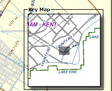
You can use the Key Map to help you situate a parcel within the LRO. The contents of the grey rectangle are the equivalent of the view displayed in the larger map.
The Key Map displays the following details:
- Water Bodies
- Township Boundaries
- Political Boundaries
- Land Registry Office Boundaries
- Location of area displayed in Map Branch in relation to the entire Land Registry Office
To display the Key Map
- Perform a property Search by Map.
- Zoom in until your locate your property on the map.
- Tip: Use the zoom in
 and zoom out
  buttons on the slider to zoom in or out of the map.
- Tip: Use the zoom in
- From the map toolbar select the Layers button.
- A drop-down menu appears.
- Select Show Key Map.
- A check-mark will appear in the checkbox option and the Key Map will be superimposed on the map.
To hide the Key Map
- Select the Layers button.
- A drop-down menu will appear
- Deselect Show Key Map.
The check-mark disappears and Key Map is hidden.